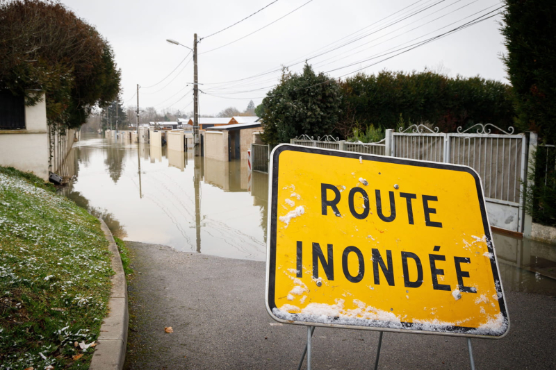
Seine-et-Marne is still on red alert for floods this Thursday, October 10, the day after Storm Kirk. The floods are less severe than expected, but the water level should remain very high. The peak of the floods was a record. Storm Kirk has passed and the storms are clearly weakening, but the worst is not over yet in some departments. This is particularly the case in Seine-et-Marne, the only department placed on red alert for floods during the passage of the depression and again this Thursday, October 10. These are the Grand and Petit Morin, two tributaries of the Seine, which crystallize all the fears. If the rains are less and have even stopped in places, the water level may continue to rise during the day, warns the Vigicrues agency. “Following the passage of storm Kirk, on the Grand Morin significant overflows are underway in the Pommeuse sector. The levels will remain high all day long. Increases in level will also be observed on the Marne, particularly at its confluence with the Grand Morin”, reports the latest report from the meteorological agency. A fact that the inhabitants of Seine-et-Marne are well aware of after three previous floods due to the overflowing of the Grand Morin and which have occurred since the beginning of the year. 
🌊 En Seine-et-Marne, le Grand Morin continue de monter ! La crue est majeure est de nombreuses rues de Coulommiers sont totalement inondées ce jeudi matin. (© Julian Geneste) pic.twitter.com/dPDd6r9y47
— Météo Express (@MeteoExpress) October 10, 2024
More than 3.50 meters of water in Seine-et-Marne
With the continued rise in water levels, the record flood level observed in 2016 was reached as announced by the Vigicrues agency. At the time, floods affected 500 municipalities in the Seine-et-Marne department and in the Grand Morin valley the river rose to 3.42 metres. With storm Kirk, levels between 3.80 and 4.16 meters were forecast, but they were revised downwards to a maximum level of 3.50 meters by the specialist agency. According to La Chaîne Météo, the peak of flooding in Seine-et-Marne was recorded at 3.56 meters. The floods and water levels “should stabilize on Friday” estimates Vigicrues.
🌧️ En Seine-et-Marne, le Grand Morin et ses affluents débordent ce mercredi soir, ici à Jouarre. L'alerte rouge est en vigueur. 🔴 (© Georges Vallée) pic.twitter.com/eVJilTiQPM
— Météo Express (@MeteoExpress) October 9, 2024
Traffic ban and closed roads
Faced with the scale of the flooding, the Seine-et-Marne prefecture announced on Wednesday evening the ban on school transport for the day of Thursday, October 10. However, it is the circulation of all vehicles that is affected by the flooding, because several roads have been completely or partially cut off at due to rising water levels, particularly the N104 at exit no. 23 Evry-Grégy-sur-Yerre or the RD934 which is flooded at the La Ferté-Gaucher Lescherolles section. The RD54 towards Fresnes-sur-Marne has been closed since Wednesday evening.
Beyond the traffic difficulties, it is recommended to limit travel as much as possible due to the red alert to avoid road congestion, accidents and to facilitate the movement of emergency services and mobilized public services.
The Seine-et-Marne prefecture has also issued a decree to prohibit the organization of any outdoor and water-based events and activities.
Flooding elsewhere in France
While the most significant flooding is expected in Seine-et-Marne, floods are forecast in other departments according to the Vigicrues bulletin: the Sèvre is expected to flood certain municipalities in Deux-Sèvres and Vendèe; The Huisne should overflow into the Eure-et-Loir, the Orne and the Sarthe. And the Oise upstream could overflow into the Aisne.
Live
14:46 – The equivalent of a month's rain fell in 24 hours
The floods are due to heavy rainfall brought by storm Kirk. In the space of 24 hours, the equivalent of a month's rain fell in Seine-et-Marne, or 50 to 70 mm of water. Significant quantities that were unable to infiltrate the ground at because of the soils already loaded with water after the last few weeks of very rainy weather. As a reminder, Seine-et-Marne had already recorded up to 100 mm of cumulative rainfall in certain areas, including Coulommiers, on September 27. The soil being saturated water, the new rains flowed towards the rivers causing them to overflow.
14:40 – A record flood peak in Seine-et-Marne
Seine-et-Marne is experiencing the peak of the floods according to weather forecasts and around the Grand Morin the water level is reaching record levels since it was recorded at 3.56 meters at midday. This is a few centimetres more than the 2016 flood, which reached 3.42 metres. Unfortunately, this record is not a cause for celebration, as the floods have covered the streets and entered houses.

